Google Maps’ satellite view suddenly reverted to showing intact Pacific Palisades and Altadena neighborhoods months after catastrophic January 2025 fires, and locals noticed — sparking anger, confusion, and questions about whether the tech giant is hiding damage during a politically charged moment in California.
Angelenos have been : the Google Maps satellite imagery depicting the Los Angeles areas of the Pacific Palisades and Altadena now shows pristine neighborhoods untouched by the devastating fires of January 2025. Users who remember the immediate post-fire updates say those earlier images clearly showed burned terrain and missing structures, so the sudden return to pre-fire scenes looks wrong to many who lived through the loss.
People on community forums and support threads are pushing Google for an explanation, arguing that maps are more than convenience; they are tools for recovery, navigation, documentation, and grief. One resident pointed out the real stakes: inaccurate public maps complicate rebuilding and make it harder for neighbors, first responders, and insurers to coordinate and verify damage claims.
On Reddit, user TinyPinkSparkles asked, “Why is Google maps back to showing old satellite images of Altadena?” She continued:
Not too long after the fire, Google updated the satellite imagery to reflect the fire and thousands of lost structures. Now it’s back to pre-fire images of houses and businesses that are no longer there. Why?
Another person reaching out via Google Maps Help wrote that the discrepancy is more than a technical glitch; it is “problematic for many reasons – navigation, recovery efforts, and mental health among them.” That exact quote captures how this affects people personally and practically, not just theoretically.
Obviously, this is problematic for many reasons – navigation, recovery efforts, and mental health among them. I’ve tried using the feedback form, but would like to know if there’s a more direct way to report this major error to Google.
I checked the maps myself and found the same mismatch others reported: no burn scars, no rubble, just tidy streets where neighborhoods were leveled. RedState Managing Editor Jennifer Van Laar took note as well:
At the bottom of the Google map I viewed, tiny copyright text read “Imagery ©2026 Airbus, Maxar Technologies, Vexcel Imaging US, Inc., Data CSUMB SFML, OA CPC, Map data ©2026 Google.” That line suggests the imagery license is current while the visual content appears dated and misleading.
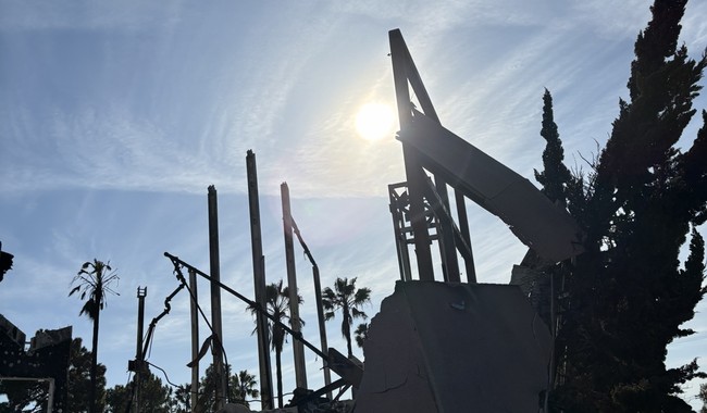
We already know Google updated imagery shortly after the fires, so this reversal is not a case of never updating. Realtor.com reported in February 2025 that Google Maps’ satellite images had revealed the catastrophic scale of the Los Angeles wildfires, including the Palisades and Eaton fires which scorched more than 37,000 acres and damaged thousands of structures.
Google Maps’ satellite images have revealed the catastrophic scale of the Los Angeles wildfires as UCLA economists reveal that the two largest blazes may have caused up to $164 billion in property and financial loss.
Igniting in early January, the Palisades and Eaton fires, driven by powerful Santa Ana winds, scorched through a combined total of more than 37,000 acres. By the time the blazes were finally contained more than three weeks later, they killed at least 29 people and ravaged over 16,240 homes and businesses.
Google has not publicly answered users demanding to know why the platform would revert to showing a pre-disaster landscape where homes and businesses no longer stand. The silence matters: when a dominant tech company leaves explanations out of reach, it breeds suspicion among citizens who expect transparency from powerful platforms.
This issue also sits against the backdrop of California politics and high-stakes statewide races, which makes any perceived misstep seem politically loaded. Conservatives have long accused big tech of bias and selective transparency, and an unexplained map reversal during a sensitive recovery period only fuels those claims.
Local residents want practical fixes: accurate imagery, clearer version histories, and direct reporting channels that actually lead to timely responses. At the same time, this episode underscores a broader concern about how centralized tech control over public information can shape what citizens see and believe during crises.
Google may have a benign technical reason for the imagery change, such as source licensing or automated refresh cycles, but without clear communication the default assumption among many will be that the company is protecting optics over people. That’s why people aren’t just annoyed; they feel underserved by a platform they rely on in emergencies.


Add comment